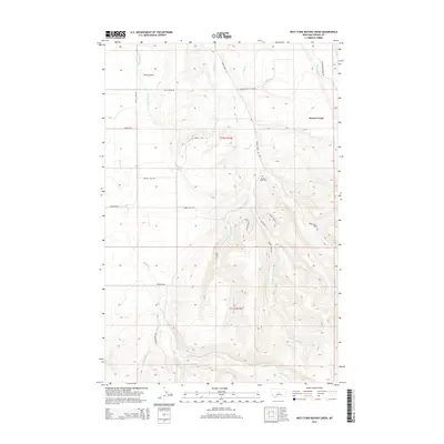
2014 Map of West Fork Beaver Creek
USGS Topo · Published 2014About this map
Beaver Creek flows through this Fergus County landscape, where the high-elevation drainages of the Snowy Mountains converge. The map documents a rural Montana setting structured by long-established ranch roads and watercourses. Central to the local community is the Beaver Creek Cem, located near the intersection of Beaver Creek Rd and several primitive tracks. The topography is defined by the complex branching of W Fork Beaver Cr and the Middle Fork Beaver Cr, which carve deep into the southern terrain near Rocky Mountain Ln. To the west, the landscape shifts toward King Coulee and the drainage of Little Rock Cr. This survey illustrates the 21st-century configuration of a working ranching district, capturing the specific alignment of historic routes like Farren Hill Rd and Rockford Rd before modern development or re-routing can obscure their original paths.
Find a feature on this map
24 named features on this map. Tap any name to fly to it.
Don’t see what you’re looking for? This feature index may not catch every label — zoom into the map to look around manually.
Map Details
Editions of this 2014 West Fork Beaver Creek Map
This is the sole edition of this map. No revisions or reprints were ever made.
Other maps of this area

1889 · Big Snowy Mountain
USGS Topo · 1:250,000

1893 · Big Snowy Mountain
USGS Topo · 1:250,000

1941 · Lewistown
USGS Topo · 1:62,500

1944 · Lewistown
USGS Topo · 1:62,500

1954 · Roundup
USGS Topo · 1:250,000

1954 · Lewistown
USGS Topo · 1:250,000

1958 · Roundup
USGS Topo · 1:250,000

1959 · Lewistown
USGS Topo · 1:250,000

1970 · Glengarry
USGS Topo · 1:24,000

1970 · Crystal Lake
USGS Topo · 1:24,000