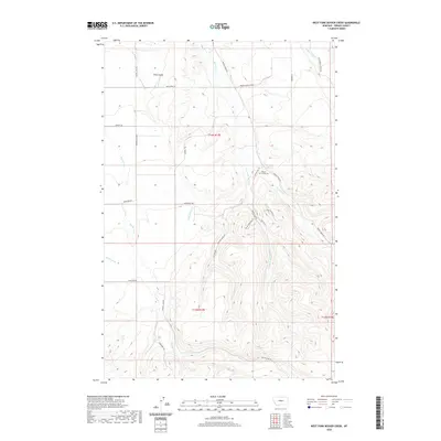
2020 Map of West Fork Beaver Creek
USGS Topo · Published 2020About this map
Beaver Creek Cem stands near the confluence of the branching drainages that define this central Montana landscape. The terrain is deeply carved by the W Fork Beaver Cr and the Middle Fork Beaver Cr, which converge as they flow toward the northeast. This 2020 topographical study captures a network of rural roads and trails, such as Crystal Lake Rd and Rockford Rd, that navigate the ridges and coulees.
Find a feature on this map
28 named features on this map. Tap any name to fly to it.
Don’t see what you’re looking for? This feature index may not catch every label — zoom into the map to look around manually.
Map Details
Editions of this 2020 West Fork Beaver Creek Map
This is the sole edition of this map. No revisions or reprints were ever made.
Other maps of this area

1889 · Big Snowy Mountain
USGS Topo · 1:250,000

1893 · Big Snowy Mountain
USGS Topo · 1:250,000

1941 · Lewistown
USGS Topo · 1:62,500

1944 · Lewistown
USGS Topo · 1:62,500

1954 · Roundup
USGS Topo · 1:250,000

1954 · Lewistown
USGS Topo · 1:250,000

1958 · Roundup
USGS Topo · 1:250,000

1959 · Lewistown
USGS Topo · 1:250,000

1970 · Glengarry
USGS Topo · 1:24,000

1970 · Crystal Lake
USGS Topo · 1:24,000