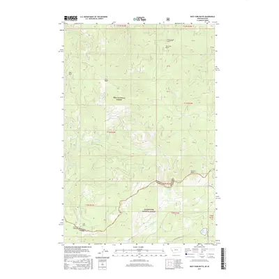
2017 Map of West Fork Butte
USGS Topo · Published 2017About this map
Lolo National Forest and Clearwater National Forest meet along the high ridgeline of the Bitterroot Range, marking the transition from Montana into Idaho. This 2017 survey captures the drainage patterns of the upper Lochsa and Lolo River systems, where Brushy Fork and Lolo Cr originate from the steep slopes of the continental divide. Notable landmarks including West Fork Butte and Skookum Butte define the horizon, while the terrain falls away into basins like Sally Basin and Chief Joseph Gulch. The map illustrates a landscape shaped by narrow forestry roads such as Elk Meadows Rd and Nat For Dev Rd 59561, which provide the primary access to high-altitude water bodies like Granite Lake and the marshy expanses of Lost Park Meadows.
Find a feature on this map
38 named features on this map. Tap any name to fly to it.
Don’t see what you’re looking for? This feature index may not catch every label — zoom into the map to look around manually.
Map Details
Editions of this 2017 West Fork Butte Map
This is the sole edition of this map. No revisions or reprints were ever made.
Other maps of this area

1911 · Lolo
USGS Topo · 1:250,000

1912 · Missoula
USGS Topo · 1:125,000

1913 · Lolo
USGS Topo · 1:250,000

1956 · Hamilton
USGS Topo · 1:250,000

1959 · Hamilton
USGS Topo · 1:250,000

1960 · Hamilton
USGS Topo · 1:250,000

1964 · Hamilton
USGS Topo · 1:250,000

1964 · Lolo Hot Springs
USGS Topo · 1:24,000

1964 · Garden Point
USGS Topo · 1:24,000

1964 · Dick Creek
USGS Topo · 1:24,000