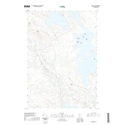
2021 Map of West Lake
USGS Topo · Published 2021About this map
West Lake and Nicatous Lake dominate this portion of Hancock County, defining a landscape shaped by glacial water bodies and prominent elevation markers. The map reveals an intricate network of smaller ponds and streams, including Crystal Pond, Loon Pond, and Otter Pond, which feed into larger systems like Guagus Stream and Mace Brook. The northeastern waters are dotted with numerous named landforms such as Cranberry Island, Bacon Island, and Perch Island, illustrating the complex shoreline of these Maine lakes.
Find a feature on this map
37 named features on this map. Tap any name to fly to it.
Don’t see what you’re looking for? This feature index may not catch every label — zoom into the map to look around manually.
Map Details
Editions of this 2021 West Lake Map
This is the sole edition of this map. No revisions or reprints were ever made.
Other maps of this area

1929 · Great Pond
USGS Topo · 1:48,000

1929 · Lead Mountain
USGS Topo · 1:48,000

1931 · Saponac
USGS Topo · 1:48,000

1932 · Nicatous Lake
USGS Topo · 1:48,000

1932 · Lead Mountain
USGS Topo · 1:62,500

1932 · Great Pond
USGS Topo · 1:62,500

1934 · Saponac
USGS Topo · 1:62,500

1934 · Nicatous Lake
USGS Topo · 1:62,500

1948 · Bangor
USGS Topo · 1:250,000

1954 · Millinocket
USGS Topo · 1:250,000