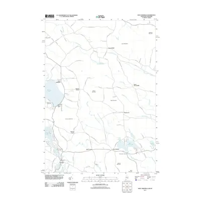
2011 Map of West Newfield
USGS Topo · Published 2011About this map
Parsonsfield and West Newfield anchor this landscape along the Maine and New Hampshire border, where the terrain is defined by a series of prominent peaks and winding watercourses. The survey details a network of rural settlements and crossroads, including Mee Corners, Stevens Corner, and Roberts Corner, which illustrate the persistent 19th-century settlement patterns of the region. The area's geography is shaped by the South River and several significant water bodies such as Province Lake and Rock Haven Lake, the latter featuring the Rock Haven Lake Dam.
Find a feature on this map
107 named features on this map. Tap any name to fly to it.
Don’t see what you’re looking for? This feature index may not catch every label — zoom into the map to look around manually.
Map Details
Editions of this 2011 West Newfield Map
This is the sole edition of this map. No revisions or reprints were ever made.
Other maps of this area

1891 · Newfield
USGS Topo · 1:62,500

1893 · Newfield
USGS Topo · 1:62,500

1910 · Kezar Falls
USGS Topo · 1:48,000

1911 · Kezar Falls
USGS Topo · 1:62,500

1928 · Wolfeboro
USGS Topo · 1:62,500

1930 · Ossipee Lake
USGS Topo · 1:62,500

1933 · Newfield
USGS Topo · 1:48,000

1937 · Newfield
USGS Topo · 1:62,500

1942 · Newfield
USGS Topo · 1:62,500

1944 · Newfield
USGS Topo · 1:62,500