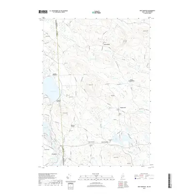
2018 Map of West Newfield
USGS Topo · Published 2018About this map
West Newfield and the surrounding borderlands of Maine and New Hampshire defined this landscape in the late 2010s, where rural crossroads like Mee Corners and Stevens Corner persist. The terrain is shaped by a sequence of peaks including Wiggin Mtn and Page Mtn, punctuated by quiet water bodies such as Champion Pond and Rock Haven Lake. Local history is deeply etched into the topography through numerous small burial grounds, including the Tuck Family Cem, Carleton Ham Cem, and the Moore Thompson Cem, which reflect generations of settlement along the upper reaches of Branch Brook and Emerson Brook. The presence of the Congregational Church near the town center highlights the community's traditional layout, while Providence Lake Beach indicates the area's continued use for recreation alongside its agricultural and residential character.
Find a feature on this map
107 named features on this map. Tap any name to fly to it.
Don’t see what you’re looking for? This feature index may not catch every label — zoom into the map to look around manually.
Map Details
Editions of this 2018 West Newfield Map
This is the sole edition of this map. No revisions or reprints were ever made.
Other maps of this area

1891 · Newfield
USGS Topo · 1:62,500

1893 · Newfield
USGS Topo · 1:62,500

1910 · Kezar Falls
USGS Topo · 1:48,000

1911 · Kezar Falls
USGS Topo · 1:62,500

1928 · Wolfeboro
USGS Topo · 1:62,500

1930 · Ossipee Lake
USGS Topo · 1:62,500

1933 · Newfield
USGS Topo · 1:48,000

1937 · Newfield
USGS Topo · 1:62,500

1942 · Newfield
USGS Topo · 1:62,500

1944 · Newfield
USGS Topo · 1:62,500