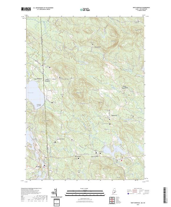
2024 Map of West Newfield
USGS Topo · Published 2024About this map
Province Lake straddles the border between Maine and New Hampshire, anchoring a landscape defined by family legacies and clustered upland settlements. In this corner of York CO and Carroll CO, the terrain is punctuated by significant elevations like Dearborn Mtn and Wiggin Mtn, which frame the small village centers of West Newfield, Parsonsfield, and Maplewood. The map reveals a high density of small family burial grounds, such as the Doe Family Graveyard, Marston Doe Graveyard, and the Tuck Family Cem, providing an exceptional resource for genealogical research in this rural borderland.
Find a feature on this map
116 named features on this map. Tap any name to fly to it.
Don’t see what you’re looking for? This feature index may not catch every label — zoom into the map to look around manually.
Map Details
Editions of this 2024 West Newfield Map
This is the sole edition of this map. No revisions or reprints were ever made.
Other maps of this area

1891 · Newfield
USGS Topo · 1:62,500

1893 · Newfield
USGS Topo · 1:62,500

1910 · Kezar Falls
USGS Topo · 1:48,000

1911 · Kezar Falls
USGS Topo · 1:62,500

1928 · Wolfeboro
USGS Topo · 1:62,500

1930 · Ossipee Lake
USGS Topo · 1:62,500

1933 · Newfield
USGS Topo · 1:48,000

1937 · Newfield
USGS Topo · 1:62,500

1942 · Newfield
USGS Topo · 1:62,500

1944 · Newfield
USGS Topo · 1:62,500