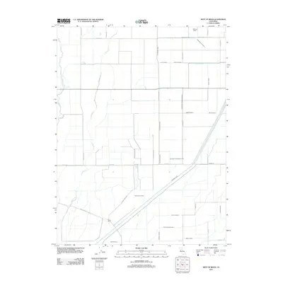
2012 Map of West of Biggs
USGS Topo · Published 2012About this map
Agricultural water management and rural homesteads define this Butte County landscape, where an intricate network of irrigation ditches supports the local farming economy. The Cherokee Canal and Main Drainage Canal serve as primary arteries for the region, while numerous named laterals like the High Gravity Lateral and Green Lateral distribute water across the flat basin. This 2012 survey illustrates the systematic division of land by ranching families and irrigation districts, notably around the Schohr Ranch and the nearby Richvale Airport. Natural drainage features like Butte Cr and Little Dry Cr wind through the grid of service roads, including Aguas Frias Rd and Richvale Hwy. The proximity of ranching infrastructure to the D D 100 Main Drain highlights the century-long effort to reclaim and manage this fertile section of the Sacramento Valley.
Find a feature on this map
35 named features on this map. Tap any name to fly to it.
Don’t see what you’re looking for? This feature index may not catch every label — zoom into the map to look around manually.
Map Details
Editions of this 2012 West of Biggs Map
This is the sole edition of this map. No revisions or reprints were ever made.
Other maps of this area

1888 · Marysville
USGS Topo · 1:125,000

1891 · Chico
USGS Topo · 1:125,000

1891 · Marysville
USGS Topo · 1:125,000

1893 · Chico
USGS Topo · 1:125,000

1894 · Marysville
USGS Topo · 1:125,000

1895 · Marysville
USGS Topo · 1:125,000

1895 · Chico
USGS Topo · 1:125,000

1911 · Sanborn Slough
USGS Topo · 1:31,680

1911 · Landlow
USGS Topo · 1:31,680

1912 · Dry Creek
USGS Topo · 1:31,680