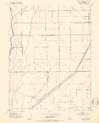
1952 Map of West of Biggs
USGS Topo · Published 1953About this map
Aguas Frias Creek meanders along the county boundary between Butte and Glenn, defining the western edge of this agricultural landscape in the early 1950s. The region is characterized by an extensive network of irrigation and drainage infrastructure, essential for the local ranching and farming operations. Major water control features like the Cherokee Canal, Browning Lateral, and Green Lateral crisscross the terrain, supporting established properties such as Maxwell Ranch and Schohr Ranch. This network of canals and ditches reveals the intensive management of water required to sustain production in the Sacramento Valley. Transportation is anchored by the Butte City Highway and Biggs Princeton Road, while smaller rural thoroughfares like Goodspeed Road and Watt Road provide access to interior parcels. The presence of a Sewage Disposal facility and several pump houses further indicates the developed nature of this rural workspace.
Find a feature on this map
28 named features on this map. Tap any name to fly to it.
Don’t see what you’re looking for? This feature index may not catch every label — zoom into the map to look around manually.
Map Details
Editions of this 1952 West of Biggs Map
3 editions found
Other maps of this area

1888 · Marysville
USGS Topo · 1:125,000

1891 · Chico
USGS Topo · 1:125,000

1891 · Marysville
USGS Topo · 1:125,000

1893 · Chico
USGS Topo · 1:125,000

1894 · Marysville
USGS Topo · 1:125,000

1895 · Marysville
USGS Topo · 1:125,000

1895 · Chico
USGS Topo · 1:125,000

1911 · Sanborn Slough
USGS Topo · 1:31,680

1911 · Landlow
USGS Topo · 1:31,680

1912 · Dry Creek
USGS Topo · 1:31,680