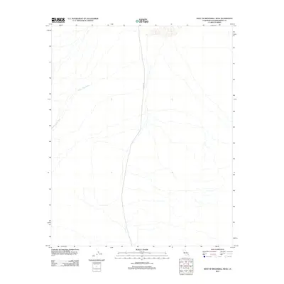
2012 Map of West of Broadwell Mesa
USGS Topo · Published 2012About this map
Hidden Valley Wash dominates the arid landscape of this San Bernardino County desert region, cutting a broad path across the western edge of the mesa. The area is defined by its isolation and the natural drainage patterns of the Mojave, where water flow is ephemeral but transformative to the terrain. A single artery of transit, Crucero Rd, provides the only significant north-south passage through the open country. This 2012 data, collected by the U.S. Geological Survey, illustrates the sparse human footprint in an environment where topographic relief and dry washes dictate the utility of the land. The map serves as a primary record of desert geomorphology before any shifting of these seasonal watercourses occurs over time.
Find a feature on this map
2 named features on this map. Tap any name to fly to it.
Don’t see what you’re looking for? This feature index may not catch every label — zoom into the map to look around manually.
Map Details
Editions of this 2012 West of Broadwell Mesa Map
This is the sole edition of this map. No revisions or reprints were ever made.
Other maps of this area

1933 · Avawatz Mountains
USGS Topo · 1:250,000

1947 · Trona
USGS Topo · 1:250,000

1948 · Trona
USGS Topo · 1:250,000

1948 · Cave Mountain
USGS Topo · 1:62,500

1951 · Cave Mountain
USGS Topo · 1:62,500

1953 · San Bernardino
USGS Topo · 1:250,000

1953 · Trona
USGS Topo · 1:250,000

1955 · Cady Mountains
USGS Topo · 1:62,500

1955 · Broadwell Lake
USGS Topo · 1:62,500

1956 · San Bernardino
USGS Topo · 1:250,000