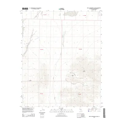
2015 Map of West of Broadwell Mesa
USGS Topo · Published 2015About this map
The Mojave Desert terrain dominates this landscape in San Bernardino County, defined by the meeting of the Cady Mountains to the west and the Bristol Mountains to the east. This 2015 survey shows a remote desert expanse where the only significant thoroughfare is Crucero Rd, a north-south corridor cutting through the alluvial valley. The drainage patterns of the area are characterized by the Hidden Valley Wash, which threads between the mountain ranges. The map provides a precise view of the Public Land Survey System (PLSS) grid, documenting townships T9N through T11N and ranges R7E through R8E. This topography is essential for understanding the natural barriers and seasonal watercourses that have historically dictated travel and access through this portion of the California desert.
Find a feature on this map
11 named features on this map. Tap any name to fly to it.
Don’t see what you’re looking for? This feature index may not catch every label — zoom into the map to look around manually.
Map Details
Editions of this 2015 West of Broadwell Mesa Map
This is the sole edition of this map. No revisions or reprints were ever made.
Other maps of this area

1933 · Avawatz Mountains
USGS Topo · 1:250,000

1947 · Trona
USGS Topo · 1:250,000

1948 · Trona
USGS Topo · 1:250,000

1948 · Cave Mountain
USGS Topo · 1:62,500

1951 · Cave Mountain
USGS Topo · 1:62,500

1953 · San Bernardino
USGS Topo · 1:250,000

1953 · Trona
USGS Topo · 1:250,000

1955 · Cady Mountains
USGS Topo · 1:62,500

1955 · Broadwell Lake
USGS Topo · 1:62,500

1956 · San Bernardino
USGS Topo · 1:250,000