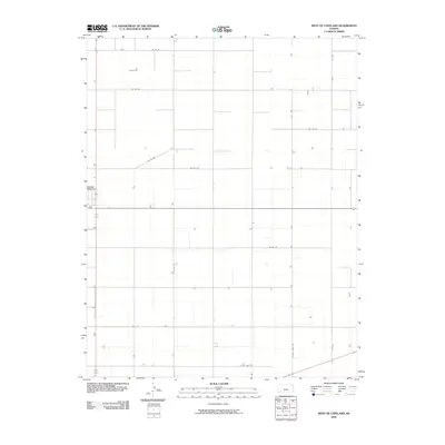
2009 Map of West of Copeland
USGS Topo · Published 2009About this map
The agricultural landscape of Haskell County, Kansas, is defined by the rigid geometry of the Public Land Survey System, as seen in this 2009 record. Located west of Copeland, the area is partitioned by an extensive network of rural thoroughfares including Co Rd 120, Co Rd 140, and Co Rd 170. These section-line roads facilitate the movement of equipment and crops across the vast plains, with County Road RR cutting across the southeastern corner. The sparse distribution of structures suggests large-scale farming operations characteristic of the High Plains, where access points like Co Rd Nn and Co Rd Oo connect isolated homesteads to the broader regional transportation grid.
Find a feature on this map
9 named features on this map. Tap any name to fly to it.
Don’t see what you’re looking for? This feature index may not catch every label — zoom into the map to look around manually.
Map Details
Editions of this 2009 West of Copeland Map
This is the sole edition of this map. No revisions or reprints were ever made.
Other maps of this area

1896 · Garden
USGS Topo · 1:125,000

1955 · Dodge City
USGS Topo · 1:250,000

1958 · Dodge City
USGS Topo · 1:250,000

1959 · Dodge City
USGS Topo · 1:250,000

1959 · Garden City 3 NW
USGS Topo · 1:24,000

1959 · Garden City 3 NE
USGS Topo · 1:24,000

1960 · Garden City 3 SW
USGS Topo · 1:24,000

1960 · Garden City 3 SE
USGS Topo · 1:24,000

1968 · Plains NW
USGS Topo · 1:24,000
1968 · Satanta
USGS Topo · 1:24,000