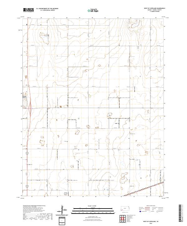
2022 Map of West of Copeland
USGS Topo · Published 2022About this map
The High Plains of Haskell County are defined here by a strict section-line grid of local routes like Co Rd 120 and Co Rd 150. This agrarian landscape remains centered on its transport network and the utility of the land, as seen in the presence of the Sublette Municipal Airport at the southern edge of the sheet. The precision of the Public Land Survey System is evident in the layout of the roads, which follow the boundaries of various townships including t28s r32w and t29s r32w. For those researching local genealogy or settlement history, the Haskell Cem stands as a notable landmark along the western border, serving as a primary point of interest in this largely open, productive landscape of southwest Kansas.
Find a feature on this map
22 named features on this map. Tap any name to fly to it.
Don’t see what you’re looking for? This feature index may not catch every label — zoom into the map to look around manually.
Map Details
Editions of this 2022 West of Copeland Map
This is the sole edition of this map. No revisions or reprints were ever made.
Other maps of this area

1896 · Garden
USGS Topo · 1:125,000

1955 · Dodge City
USGS Topo · 1:250,000

1958 · Dodge City
USGS Topo · 1:250,000

1959 · Dodge City
USGS Topo · 1:250,000

1959 · Garden City 3 NW
USGS Topo · 1:24,000

1959 · Garden City 3 NE
USGS Topo · 1:24,000

1960 · Garden City 3 SW
USGS Topo · 1:24,000

1960 · Garden City 3 SE
USGS Topo · 1:24,000

1968 · Plains NW
USGS Topo · 1:24,000
1968 · Satanta
USGS Topo · 1:24,000