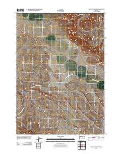
2011 Map of West of Hampton
USGS Topo · Published 2011About this map
The High Desert environment of Deschutes County is prominently displayed in this 2011 survey, showing a landscape defined by seasonal watercourses and straight-line access roads. The South Fork Crooked River meanders across the southern portion of the quadrangle, serving as the primary drainage for the surrounding basins. To the north, the terrain is shaped by Desert Creek and Lizard Creek, which cut through the arid plains. Human impact is largely limited to the transport corridors of Harman Rd and Lizard Creek Rd, reflecting the low-density development typical of this portion of Central Oregon. The map illustrates the transition from river bottoms to elevated desert plateaus, capturing the precise layout of local infrastructure in the early 21st century.
Find a feature on this map
6 named features on this map. Tap any name to fly to it.
Don’t see what you’re looking for? This feature index may not catch every label — zoom into the map to look around manually.
Map Details
Editions of this 2011 West of Hampton Map
This is the sole edition of this map. No revisions or reprints were ever made.
Other maps of this area

1955 · Crescent
USGS Topo · 1:250,000

1957 · Crescent
USGS Topo · 1:250,000

1958 · Crescent
USGS Topo · 1:250,000

1970 · Crescent
USGS Topo · 1:250,000

1983 · Potato Lake
USGS Topo · 1:24,000

1983 · Hampton Butte
USGS Topo · 1:24,000

1983 · Imperial Valley South
USGS Topo · 1:24,000

1983 · Benjamin Lake
USGS Topo · 1:24,000

1983 · West of Hampton
USGS Topo · 1:24,000
1983 · Frederick Butte
USGS Topo · 1:24,000