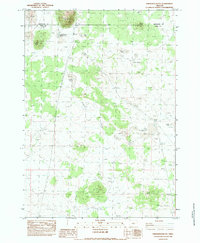
1983 Map of Frederick Butte
USGS Topo · Published 1983About this map
Frederick Butte rises as a prominent landmark along the boundary between Deschutes and Lake counties in this high-desert region of Oregon. This 1983 provisional survey documents an arid landscape where water management is critical, as seen in the Concentration Reservoir No 3 and scattered seasonal basins like Little Benjamin Lake, Duck Lake, and Croker Lake. The terrain is defined by a series of volcanic features including Indian Butte, Peters Butte, and West Butte, which dictate the drainage patterns of ephemeral flows like Peters Creek. A notable piece of modern infrastructure, a Single Wooden Pole Powerline, traverses the western portion of the quadrangle, illustrating the reach of utilities into this sparsely populated territory. The presence of Hayes Spring highlights the few reliable water sources that would have been vital for early livestock operations in this interior basin.
Find a feature on this map
16 named features on this map. Tap any name to fly to it.
Don’t see what you’re looking for? This feature index may not catch every label — zoom into the map to look around manually.
Map Details
Editions of this 1983 Frederick Butte Map
This is the sole edition of this map. No revisions or reprints were ever made.
Other maps of this area

1955 · Crescent
USGS Topo · 1:250,000

1957 · Crescent
USGS Topo · 1:250,000

1958 · Crescent
USGS Topo · 1:250,000

1970 · Crescent
USGS Topo · 1:250,000

1981 · Moonlight Butte
USGS Topo · 1:24,000

1981 · Mean Rock Well
USGS Topo · 1:24,000

1982 · Peters Creek Sink
USGS Topo · 1:24,000
1983 · Soldiers Cap
USGS Topo · 1:24,000

1983 · Imperial Valley South
USGS Topo · 1:24,000

1983 · Benjamin Lake
USGS Topo · 1:24,000