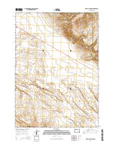
2014 Map of West of Hampton
USGS Topo · Published 2014About this map
Hampton Buttes dominate the northeastern corner of this arid landscape, where the elevation rises significantly above the surrounding plateau. The terrain is defined by the transition into the High Desert, a region characterized by its sparse water sources and expansive open spaces. Seasonal drainage patterns are visible through the winding paths of Lizard Cr and Desert Cr, which flow toward the southern reaches of the quadrangle. The S Fork Crooked River meanders across the central and western sections, tracing a vital lifeline through this part of Deschutes and Crook Counties. Human presence is marked primarily by transportation corridors, including the prominent route of Us-20 and rural access points like Harmon Rd. This map captures a moment in the modern management of Oregon’s high plains, showing the intersection of public land survey sections and the natural topography of the desert floor.
Find a feature on this map
13 named features on this map. Tap any name to fly to it.
Don’t see what you’re looking for? This feature index may not catch every label — zoom into the map to look around manually.
Map Details
Editions of this 2014 West of Hampton Map
This is the sole edition of this map. No revisions or reprints were ever made.
Other maps of this area

1955 · Crescent
USGS Topo · 1:250,000

1957 · Crescent
USGS Topo · 1:250,000

1958 · Crescent
USGS Topo · 1:250,000

1970 · Crescent
USGS Topo · 1:250,000

1983 · Potato Lake
USGS Topo · 1:24,000

1983 · Hampton Butte
USGS Topo · 1:24,000

1983 · Imperial Valley South
USGS Topo · 1:24,000

1983 · Benjamin Lake
USGS Topo · 1:24,000

1983 · West of Hampton
USGS Topo · 1:24,000
1983 · Frederick Butte
USGS Topo · 1:24,000