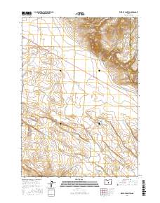
2017 Map of West of Hampton
USGS Topo · Published 2017About this map
Hampton Buttes rise as a prominent landform on this high-altitude plateau, where the northern reaches of the High Desert meet the administrative line between Deschutes and Crook counties. The landscape is defined by sparse drainage patterns and vast open terrain, typical of central Oregon's interior. Narrow watercourses like Lizard Cr and Desert Cr cut through the volcanic topography, while isolated tracks such as Harman Rd and Lizard Creek Rd provide the only significant access through these sprawling sections. The map preserves the specific cattle-country and rangeland boundary system of the early 21st century, showing the intersection of township lines t21s r20e and t22s r20e across a largely uninhabited and arid expanse.
Find a feature on this map
11 named features on this map. Tap any name to fly to it.
Don’t see what you’re looking for? This feature index may not catch every label — zoom into the map to look around manually.
Map Details
Editions of this 2017 West of Hampton Map
This is the sole edition of this map. No revisions or reprints were ever made.
Other maps of this area

1955 · Crescent
USGS Topo · 1:250,000

1957 · Crescent
USGS Topo · 1:250,000

1958 · Crescent
USGS Topo · 1:250,000

1970 · Crescent
USGS Topo · 1:250,000

1983 · Potato Lake
USGS Topo · 1:24,000

1983 · Hampton Butte
USGS Topo · 1:24,000

1983 · Imperial Valley South
USGS Topo · 1:24,000

1983 · Benjamin Lake
USGS Topo · 1:24,000

1983 · West of Hampton
USGS Topo · 1:24,000
1983 · Frederick Butte
USGS Topo · 1:24,000