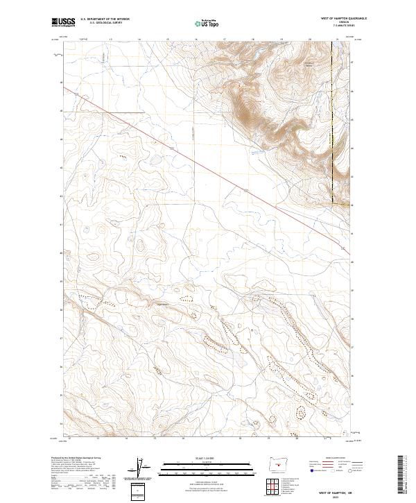
2023 Map of West of Hampton
USGS Topo · Published 2023About this map
Hampton Buttes dominate the northeastern corner of this arid landscape, providing a vertical contrast to the surrounding High Desert. This map illustrates the intersection of Deschutes and Crook counties within a region defined by seasonal drainages such as Lizard Creek and Desert Creek. The terrain is marked by a network of rural routes and specialized paths, including Harman Rd and the Cougar Butte Atv Trl, which navigate the various buttes and draws. The survey details a sparsely populated expanse where the land is primarily organized by the Public Land Survey System, as seen in the grid of township and range lines. The topography reveals the subtle shifts of the high-elevation basin, documenting the natural features and backcountry roads that serve this portion of Central Oregon.
Find a feature on this map
12 named features on this map. Tap any name to fly to it.
Don’t see what you’re looking for? This feature index may not catch every label — zoom into the map to look around manually.
Map Details
Editions of this 2023 West of Hampton Map
This is the sole edition of this map. No revisions or reprints were ever made.
Other maps of this area

1955 · Crescent
USGS Topo · 1:250,000

1957 · Crescent
USGS Topo · 1:250,000

1958 · Crescent
USGS Topo · 1:250,000

1970 · Crescent
USGS Topo · 1:250,000

1983 · Potato Lake
USGS Topo · 1:24,000

1983 · Hampton Butte
USGS Topo · 1:24,000

1983 · Imperial Valley South
USGS Topo · 1:24,000

1983 · Benjamin Lake
USGS Topo · 1:24,000

1983 · West of Hampton
USGS Topo · 1:24,000
1983 · Frederick Butte
USGS Topo · 1:24,000