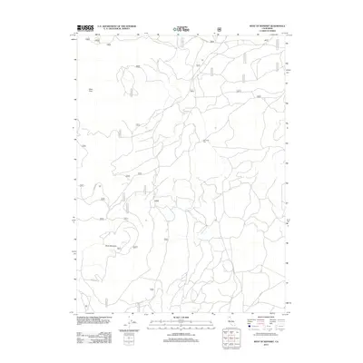
2012 Map of West of Kephart
USGS Topo · Published 2012About this map
Glass Flow and the heights of Black Mountain dominate this Siskiyou County landscape, revealing a terrain shaped by volcanic activity and modern forestry management. The presence of Old Camp One serves as a point of interest for local history, suggesting former logging or worker habitation sites that have since been integrated into the forest service infrastructure. A dense network of United States Forest Service routes, including Tionesta Rd, Usfs Rd 97, and Usfs 43 N 57, crisscrosses the region, illustrating the complex access required for timber management and fire suppression. This 2012 survey provides a precise record of the road systems and topographical shifts in this high-elevation California forest, preserving the location of named landmarks and back-country routes as they existed in the early twenty-first century.
Find a feature on this map
35 named features on this map. Tap any name to fly to it.
Don’t see what you’re looking for? This feature index may not catch every label — zoom into the map to look around manually.
Map Details
Editions of this 2012 West of Kephart Map
This is the sole edition of this map. No revisions or reprints were ever made.
Other maps of this area

1886 · Modoc Lava Bed
USGS Topo · 1:250,000

1892 · Modoc Lava-Bed
USGS Topo · 1:250,000

1932 · Bartle
USGS Topo · 1:96,000

1939 · Bartle
USGS Topo · 1:125,000

1952 · Timber Mountain
USGS Topo · 1:62,500

1952 · Medicine Lake
USGS Topo · 1:62,500

1954 · Alturas
USGS Topo · 1:250,000

1958 · Alturas
USGS Topo · 1:250,000

1961 · Hambone
USGS Topo · 1:62,500

1962 · Alturas
USGS Topo · 1:250,000