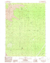
1988 Map of West of Kephart
USGS Topo · Published 1988About this map
Glass Flow and the towering heights of Black Mountain dominate this volcanic landscape along the Siskiyou and Modoc county border. This 1980s provisional survey illustrates a region shaped by geologic activity and industrial resource extraction within the Modoc National Forest. Industrial activity is evident in the numerous Gravel Pits and a specialized Pumice Mine located in the northwestern corner, where volcanic debris provided commercial value. The map identifies the site of Old Camp One, a localized settlement point amidst the network of 4wd tracks and forest roads. To the south, the landscape transitions toward the Long Bell State Game Refuge, which is traversed by significant utility infrastructure, including a Pipeline and major Transmission Lines that cut through the timber and lava fields.
Find a feature on this map
15 named features on this map. Tap any name to fly to it.
Don’t see what you’re looking for? This feature index may not catch every label — zoom into the map to look around manually.
Map Details
Editions of this 1988 West of Kephart Map
This is the sole edition of this map. No revisions or reprints were ever made.
Other maps of this area

1886 · Modoc Lava Bed
USGS Topo · 1:250,000

1892 · Modoc Lava-Bed
USGS Topo · 1:250,000

1932 · Bartle
USGS Topo · 1:96,000

1939 · Bartle
USGS Topo · 1:125,000

1952 · Timber Mountain
USGS Topo · 1:62,500

1952 · Medicine Lake
USGS Topo · 1:62,500

1954 · Alturas
USGS Topo · 1:250,000

1958 · Alturas
USGS Topo · 1:250,000

1961 · Hambone
USGS Topo · 1:62,500

1962 · Alturas
USGS Topo · 1:250,000