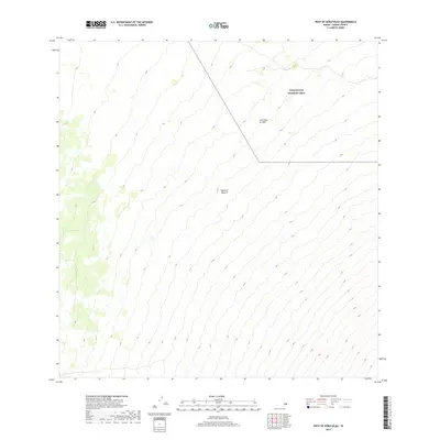
2017 Map of West of Kokoolau
USGS Topo · Published 2017About this map
The Island of Hawai'i landscape is defined here by the stark geologic history of the mid-nineteenth century. A massive corridor of basaltic debris from the Lava Flow of 1859 cuts across the terrain, illustrating the volcanic activity that shaped this portion of the archipelago. This flow originated from Mauna Loa and reached all the way to the ocean, leaving a permanent mark on the topography that remains a primary feature of the region. To the north, the boundary of the Pohakuloa Training Area indicates the modern military use of these high-elevation lands, which sit in the saddle between the island's great volcanic peaks. The contour lines reveal a steady, relentless elevation gain, depicting a world of lava and ash far removed from the coastal settlements.
Find a feature on this map
3 named features on this map. Tap any name to fly to it.
Don’t see what you’re looking for? This feature index may not catch every label — zoom into the map to look around manually.
Map Details
Editions of this 2017 West of Kokoolau Map
This is the sole edition of this map. No revisions or reprints were ever made.
Other maps of this area

1927 · Kaohe
USGS Topo · 1:62,500

1928 · Kailua
USGS Topo · 1:62,500

1928 · Mauna Loa
USGS Topo · 1:62,500

1930 · Kaohe
USGS Topo · 1:62,500

1954 · Hawaii South
USGS Topo · 1:250,000

1954 · Hawaii North
USGS Topo · 1:250,000

1956 · Puu Koli
USGS Topo · 1:24,000

1956 · Puu O Uo
USGS Topo · 1:24,000
1956 · Kokoolau
USGS Topo · 1:24,000

1956 · Naohueleelua
USGS Topo · 1:24,000