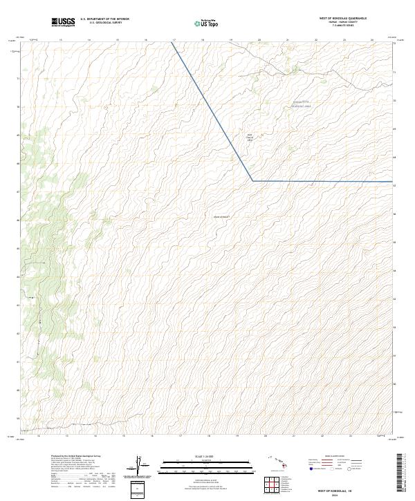
2024 Map of West of Kokoolau
USGS Topo · Published 2024About this map
Island of Hawai‘i terrain is defined here by the stark geological evidence of volcanic activity, specifically the notable Lava Flow of 1859. This massive basaltic feature cuts diagonally across the landscape, marking a significant 19th-century eruption from Mauna Loa. The 2024 survey depicts a sparsely populated region where human activity is largely restricted to the sprawling Pohakuloa Training Area. This military installation dominates the northeastern portion of the sheet, situated within the high-elevation saddle between Hawaii's massive volcanic peaks. The map consists almost entirely of elevation contours that reveal the steady, rising slopes of the volcanic interior, offering a precise view of the topography surrounding one of the island's most historically significant lava flows.
Find a feature on this map
4 named features on this map. Tap any name to fly to it.
Don’t see what you’re looking for? This feature index may not catch every label — zoom into the map to look around manually.
Map Details
Editions of this 2024 West of Kokoolau Map
This is the sole edition of this map. No revisions or reprints were ever made.
Other maps of this area

1927 · Kaohe
USGS Topo · 1:62,500

1928 · Kailua
USGS Topo · 1:62,500

1928 · Mauna Loa
USGS Topo · 1:62,500

1930 · Kaohe
USGS Topo · 1:62,500

1954 · Hawaii South
USGS Topo · 1:250,000

1954 · Hawaii North
USGS Topo · 1:250,000

1956 · Puu Koli
USGS Topo · 1:24,000

1956 · Puu O Uo
USGS Topo · 1:24,000
1956 · Kokoolau
USGS Topo · 1:24,000

1956 · Naohueleelua
USGS Topo · 1:24,000