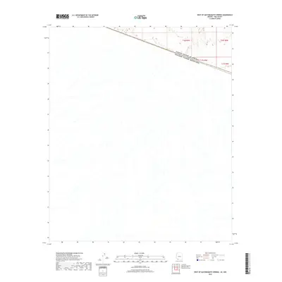
2018 Map of West of Quitobaquito Springs
USGS Topo · Published 2018About this map
The international boundary between the United States of America and Estados Unidos Mexicanos defines the character of this arid landscape in Pima County. Surveyed by the U.S. Geological Survey, the map documents the sparse, wash-dissected terrain where the Sonoran Desert crosses national lines. The topography is dominated by ephemeral drainage patterns flowing south and west across the border, illustrating the natural continuity of the landscape despite political divisions. The grid of the Public Land Survey System is represented by townships including T16s R9w and T17s R9w, providing a framework for the remote ranching and conservation lands in this region. This modern survey captures the environment in its current state, highlighting the intersection of international borders and natural desert geography.
Find a feature on this map
5 named features on this map. Tap any name to fly to it.
Don’t see what you’re looking for? This feature index may not catch every label — zoom into the map to look around manually.
Map Details
Editions of this 2018 West of Quitobaquito Springs Map
This is the sole edition of this map. No revisions or reprints were ever made.
Other maps of this area

1953 · Ajo
USGS Topo · 1:250,000

1954 · Sonoyta
USGS Topo · 1:250,000

1957 · Ajo
USGS Topo · 1:250,000

1958 · Ajo
USGS Topo · 1:250,000

1962 · Ajo
USGS Topo · 1:250,000

1963 · Ajo
USGS Topo · 1:250,000

1963 · Quitobaquito Springs
USGS Topo · 1:62,500

1963 · Lukeville
USGS Topo · 1:250,000
1964 · Agua Dulce Mts
USGS Topo · 1:62,500

1965 · O'Neill Hills
USGS Topo · 1:62,500