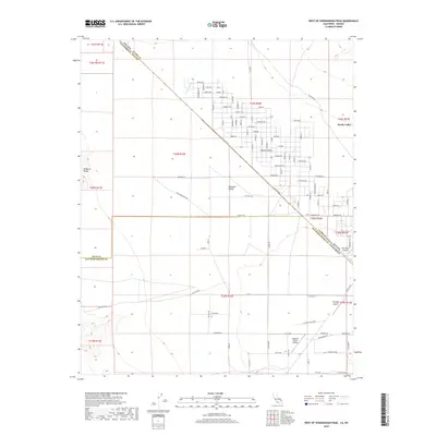
2018 Map of West of Shenandoah Peak
USGS Topo · Published 2018About this map
Sandy Valley sits at the high-desert intersection of the California and Nevada state line, where the arid Mesquite Valley meets the Mojave Desert. This 2018 survey illustrates a distinctive grid of mineral-themed streets, such as Borax Ave, Coal Ave, and Quartz Ave, reflecting the region's deep ties to prospector history. The geography is defined by its transition from the steep eastern slopes of the Kingston Range down into the alluvial plains where Potosi Wash drains toward the valley floor. Aviation is a notable component of this remote landscape, with several private airstrips including Sky Ranch Airport, Heritage Airport, and Kingston Ranch Airport servicing the dispersed residential and ranching properties. The map meticulously tracks the surveyed township and range lines across the State Line between Inyo County and Clark County.
Find a feature on this map
68 named features on this map. Tap any name to fly to it.
Don’t see what you’re looking for? This feature index may not catch every label — zoom into the map to look around manually.
Map Details
Editions of this 2018 West of Shenandoah Peak Map
This is the sole edition of this map. No revisions or reprints were ever made.
Other maps of this area

1910 · Ivanpah
USGS Topo · 1:250,000

1912 · Ivanpah
USGS Topo · 1:250,000

1942 · Ivanpah
USGS Topo · 1:250,000

1947 · Kingman
USGS Topo · 1:250,000

1948 · Kingman
USGS Topo · 1:250,000

1954 · Kingman
USGS Topo · 1:250,000

1955 · Kingman
USGS Topo · 1:250,000

1955 · Kingston Peak
USGS Topo · 1:62,500

1956 · Clark Mountain
USGS Topo · 1:62,500

1956 · Shenandoah Peak
USGS Topo · 1:62,500