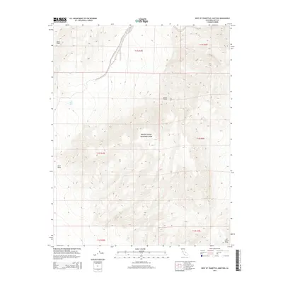
2015 Map of West of Teakettle Junction
USGS Topo · Published 2015About this map
Death Valley National Park encompasses the vast majority of this high-desert landscape, where dramatic elevation changes define the transition from valley floors to mountain crests. The arid basin of Saline Valley sits in the western portion of the sheet, shadowed by the towering peaks of the Saline Range. This 2015 survey highlights the critical water sources that sustain life in such an extreme environment, most notably the Upper Warm Spring located near the base of the mountains. To the east, the terrain rises sharply toward the Last Chance Range, illustrating the complex geological folding characteristic of the northern Mojave Desert. The map provides a precise view of the land as it appeared in the early 21st century, documented by the U.S. Geological Survey through modern satellite imagery and elevation datasets.
Find a feature on this map
12 named features on this map. Tap any name to fly to it.
Don’t see what you’re looking for? This feature index may not catch every label — zoom into the map to look around manually.
Map Details
Editions of this 2015 West of Teakettle Junction Map
This is the sole edition of this map. No revisions or reprints were ever made.
Other maps of this area

1908 · Ballarat
USGS Topo · 1:250,000

1913 · Ballarat
USGS Topo · 1:250,000

1948 · Death Valley
USGS Topo · 1:250,000

1950 · New York Butte
USGS Topo · 1:62,500

1950 · Ubehebe Peak
USGS Topo · 1:62,500

1951 · New York Butte
USGS Topo · 1:62,500

1951 · Ubehebe Peak
USGS Topo · 1:62,500

1951 · Waucoba Wash
USGS Topo · 1:62,500

1954 · Death Valley
USGS Topo · 1:250,000

1956 · Death Valley
USGS Topo · 1:250,000