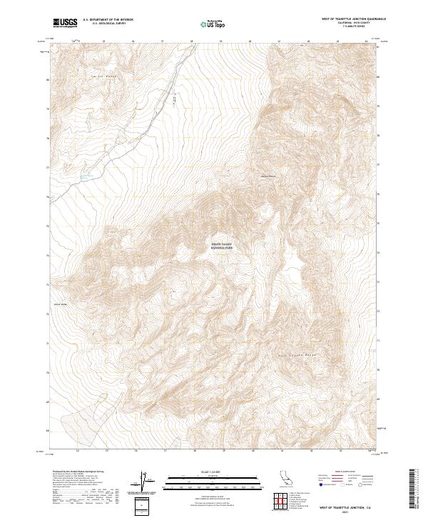
2021 Map of West of Teakettle Junction
USGS Topo · Published 2021About this map
Death Valley National Park encompasses the majority of this high-desert terrain, where the massive geological structures of the Saline Range and Last Chance Range converge. This 2021 survey illustrates a landscape defined by extreme elevation changes and scarce water sources, most notably the Upper Warm Spring located in the northwestern portion of the quadrangle. The map documents the vast, arid expanse of the Saline Valley as it transitions into the broader Mojave Desert environment. These geographic features reflect the challenging conditions for settlement in this part of Inyo County, remaining largely defined by public land boundaries and natural topographic barriers rather than modern development.
Find a feature on this map
12 named features on this map. Tap any name to fly to it.
Don’t see what you’re looking for? This feature index may not catch every label — zoom into the map to look around manually.
Map Details
Editions of this 2021 West of Teakettle Junction Map
This is the sole edition of this map. No revisions or reprints were ever made.
Other maps of this area

1908 · Ballarat
USGS Topo · 1:250,000

1913 · Ballarat
USGS Topo · 1:250,000

1948 · Death Valley
USGS Topo · 1:250,000

1950 · New York Butte
USGS Topo · 1:62,500

1950 · Ubehebe Peak
USGS Topo · 1:62,500

1951 · New York Butte
USGS Topo · 1:62,500

1951 · Ubehebe Peak
USGS Topo · 1:62,500

1951 · Waucoba Wash
USGS Topo · 1:62,500

1954 · Death Valley
USGS Topo · 1:250,000

1956 · Death Valley
USGS Topo · 1:250,000