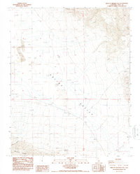
1987 Map of West of Ubehebe Peak
USGS Topo · Published 1987About this map
Saline Valley dominates this 1987 survey, revealing a landscape defined by dramatic elevation changes and desert geology. The northeastern portion of the map is marked by unnamed peaks rising over 3,000 feet, while the floor of the valley contains a significant field of Sand Dunes. The isolation of the region is evident in the sparse infrastructure, consisting primarily of a single 4wd track and scattered Prospects in the higher elevations.
Find a feature on this map
13 named features on this map. Tap any name to fly to it.
Don’t see what you’re looking for? This feature index may not catch every label — zoom into the map to look around manually.
Map Details
Editions of this 1987 West of Ubehebe Peak Map
This is the sole edition of this map. No revisions or reprints were ever made.
Other maps of this area

1908 · Ballarat
USGS Topo · 1:250,000

1913 · Ballarat
USGS Topo · 1:250,000

1948 · Death Valley
USGS Topo · 1:250,000

1950 · New York Butte
USGS Topo · 1:62,500

1950 · Ubehebe Peak
USGS Topo · 1:62,500

1951 · New York Butte
USGS Topo · 1:62,500

1951 · Ubehebe Peak
USGS Topo · 1:62,500

1951 · Waucoba Wash
USGS Topo · 1:62,500

1954 · Death Valley
USGS Topo · 1:250,000

1956 · Death Valley
USGS Topo · 1:250,000