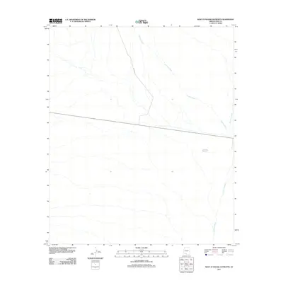
2011 Map of West of Wahak Hotrontk
USGS Topo · Published 2011About this map
Hickiwan Wash and San Simon Wash define the hydrology of this arid Pima County landscape, where ephemeral watercourses drain a high-desert environment in the years following the turn of the millennium. The terrain is characterized by a network of braided drainage patterns that cut through the valley floor, illustrating the complex alluvial processes of the Sonoran region. Human infrastructure is notably sparse, anchored primarily by the passage of Indian Rte 17, which traverses the northwestern corner of the quadrangle. This alignment suggests a region primarily dedicated to transit and natural resource management rather than dense settlement, providing a clear view of the area's undeveloped character as documented by the U.S. Geological Survey in 2011.
Find a feature on this map
3 named features on this map. Tap any name to fly to it.
Don’t see what you’re looking for? This feature index may not catch every label — zoom into the map to look around manually.
Map Details
Editions of this 2011 West of Wahak Hotrontk Map
This is the sole edition of this map. No revisions or reprints were ever made.
Other maps of this area

1953 · Ajo
USGS Topo · 1:250,000

1957 · Ajo
USGS Topo · 1:250,000

1958 · Ajo
USGS Topo · 1:250,000

1962 · Ajo
USGS Topo · 1:250,000

1963 · Ajo
USGS Topo · 1:250,000

1963 · Sikort Chuapo Mts
USGS Topo · 1:62,500

1963 · Mt. Ajo
USGS Topo · 1:62,500

1963 · Cimarron Peak
USGS Topo · 1:62,500

1963 · Pisinimo
USGS Topo · 1:62,500

1967 · Ajo
USGS Topo · 1:250,000