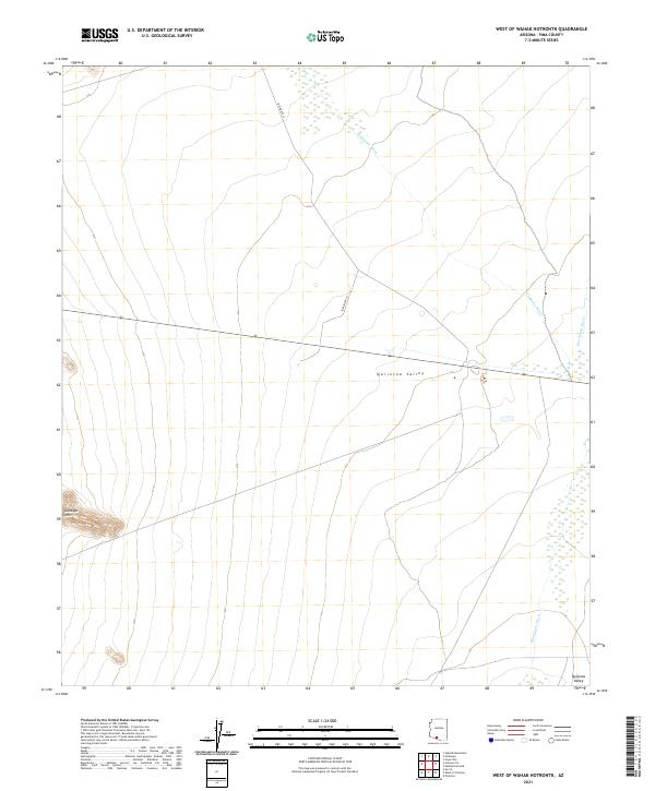
2021 Map of West of Wahak Hotrontk
USGS Topo · Published 2021About this map
Quijotoa Valley dominates this arid landscape in the Sonoran Desert, where ephemeral watercourses define the drainage patterns of the basin. The topographic data reveals the convergence of Hickiwan Wash and San Simon Wash, which flow across the flat valley floor between subtle rises in elevation. To the southwest, the Gunsight Hills provide a distinct vertical landmark against the otherwise low-lying terrain. Human infrastructure is limited to the crossing of Indian Rte 17, a critical transport corridor through this remote part of Pima County. The map is organized by the Public Land Survey System, showing the intersections of several townships, including t14s r2w and t14s r1w. This layout reflects the systematic division of the American West, highlighting how modern roadways and indigenous routes continue to follow the natural contours of the desert floor.
Find a feature on this map
12 named features on this map. Tap any name to fly to it.
Don’t see what you’re looking for? This feature index may not catch every label — zoom into the map to look around manually.
Map Details
Editions of this 2021 West of Wahak Hotrontk Map
This is the sole edition of this map. No revisions or reprints were ever made.
Other maps of this area

1953 · Ajo
USGS Topo · 1:250,000

1957 · Ajo
USGS Topo · 1:250,000

1958 · Ajo
USGS Topo · 1:250,000

1962 · Ajo
USGS Topo · 1:250,000

1963 · Ajo
USGS Topo · 1:250,000

1963 · Sikort Chuapo Mts
USGS Topo · 1:62,500

1963 · Mt. Ajo
USGS Topo · 1:62,500

1963 · Cimarron Peak
USGS Topo · 1:62,500

1963 · Pisinimo
USGS Topo · 1:62,500

1967 · Ajo
USGS Topo · 1:250,000