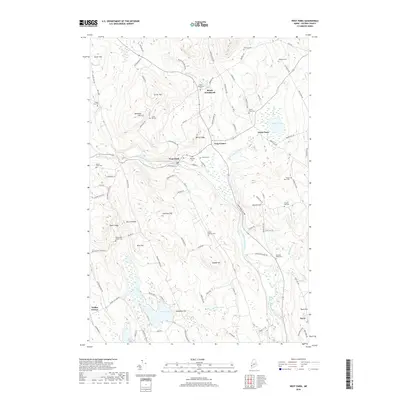
2018 Map of West Paris
USGS Topo · Published 2018About this map
The Little Androscoggin River carves a central path through this Oxford County landscape, creating notable landmarks like Snow Falls Gorge and Bisco Falls as it flows south. Settlement is concentrated in the village of West Paris, with outlying hamlets including South Woodstock, North Paris, and Trap Corner connected by a network of rural roads such as Tuelltown Rd and Paris Hill Rd.
Find a feature on this map
104 named features on this map. Tap any name to fly to it.
Don’t see what you’re looking for? This feature index may not catch every label — zoom into the map to look around manually.
Map Details
Editions of this 2018 West Paris Map
This is the sole edition of this map. No revisions or reprints were ever made.
Other maps of this area

1896 · Norway
USGS Topo · 1:62,500

1908 · Poland
USGS Topo · 1:62,500

1911 · Bryant Pond
USGS Topo · 1:62,500

1911 · Buckfield
USGS Topo · 1:62,500

1913 · Buckfield
USGS Topo · 1:62,500

1914 · Bryant Pond
USGS Topo · 1:62,500

1940 · Poland
USGS Topo · 1:62,500

1942 · Buckfield
USGS Topo · 1:62,500

1942 · Bryant Pond
USGS Topo · 1:62,500

1942 · Poland
USGS Topo · 1:62,500