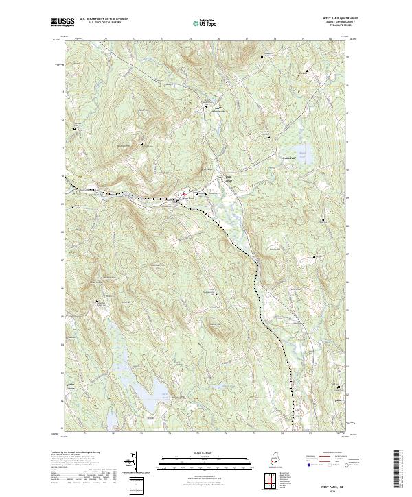
2024 Map of West Paris
USGS Topo · Published 2024About this map
West Paris and the winding valley of the Little Androscoggin River serve as the focal point for this survey of Oxford County. The landscape is defined by its transition from industrial riverfront to upland hill farms, where family names are etched into the terrain at sites like Stearns Hill and Fuller Hill. A remarkable concentration of burial grounds, including the Finnish Cem and Porter Neighborhood Cem, reveals the deep genealogical roots of these highland communities. To the north, South Woodstock and North Paris flank the higher elevations of Whitman Mtn, while the waterway drops through notable natural features such as Snow Falls Gorge and Bisco Falls. The network of backroads, including the humorously named Road Less Traveled Rd, connects long-standing intersections like Trap Corner and Nobles Corner, illustrating a settlement pattern that remains closely tied to the granite ledges and river bends of the region.
Find a feature on this map
114 named features on this map. Tap any name to fly to it.
Don’t see what you’re looking for? This feature index may not catch every label — zoom into the map to look around manually.
Map Details
Editions of this 2024 West Paris Map
This is the sole edition of this map. No revisions or reprints were ever made.
Other maps of this area

1896 · Norway
USGS Topo · 1:62,500

1908 · Poland
USGS Topo · 1:62,500

1911 · Bryant Pond
USGS Topo · 1:62,500

1911 · Buckfield
USGS Topo · 1:62,500

1913 · Buckfield
USGS Topo · 1:62,500

1914 · Bryant Pond
USGS Topo · 1:62,500

1940 · Poland
USGS Topo · 1:62,500

1942 · Buckfield
USGS Topo · 1:62,500

1942 · Bryant Pond
USGS Topo · 1:62,500

1942 · Poland
USGS Topo · 1:62,500