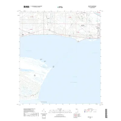
2018 Map of West Pass
USGS Topo · Published 2018About this map
Apalachicola sits at the nexus of the Apalachicola River Intracoastal Waterway and the expansive Apalachicola Bay, a landscape defined by the shifting boundaries of water and marsh. The town's grid extends toward Scipio Creek and Turtle Harbor, while the Apalachicola Regional Airport-Cleve Randolph Field occupies the central flats. To the west, the sprawling marshlands of Saint Vincent Island separate Saint Vincent Sound from the Gulf of Mexico. This coastal geography is marked by intricate drainage patterns like Mallard Slough and isolated freshwater features such as Lake Number 1 and Oyster Pond. Small landings and settlements like Tilton and Nine Mile dot the inland roads, connected by routes like Tilton Rd and Hathcock Rd, reflecting the region's enduring reliance on the waterfront and its surrounding wetlands.
Find a feature on this map
61 named features on this map. Tap any name to fly to it.
Don’t see what you’re looking for? This feature index may not catch every label — zoom into the map to look around manually.
Map Details
Editions of this 2018 West Pass Map
This is the sole edition of this map. No revisions or reprints were ever made.
Other maps of this area

1943 · West Pass
USGS Topo · 1:31,680

1943 · Apalachicola
USGS Topo · 1:31,680

1943 · Indian Pass
USGS Topo · 1:24,000

1943 · Jackson River
USGS Topo · 1:24,000

1944 · Apalachicola
USGS Topo · 1:24,000

1945 · Cape St. George
USGS Topo · 1:31,680

1945 · Lake Wimico
USGS Topo · 1:31,680

1945 · Beverly
USGS Topo · 1:31,680

1945 · Jackson River
USGS Topo · 1:31,680

1945 · Indian Pass
USGS Topo · 1:31,680