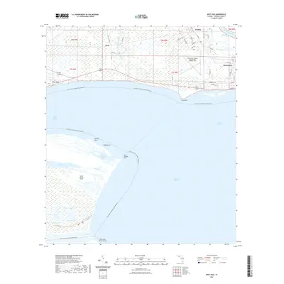
2021 Map of West Pass
USGS Topo · Published 2021About this map
Saint Vincent Island dominates the southwestern portion of this coastal survey, serving as a significant natural barrier between Saint Vincent Sound and the open gulf waters. The island's complex hydrology is meticulously detailed, showing a network of interior freshwater bodies such as Lake Number 2 and Lake Number 4, alongside Mallard Slough and Back Slough. Across the West Pass, the tip of Little Saint George Island marks the southern extent of the frame, highlighting the shifting shoals and points like Paradise Point and Cabbage Top.
Find a feature on this map
59 named features on this map. Tap any name to fly to it.
Don’t see what you’re looking for? This feature index may not catch every label — zoom into the map to look around manually.
Map Details
Editions of this 2021 West Pass Map
This is the sole edition of this map. No revisions or reprints were ever made.
Other maps of this area

1943 · West Pass
USGS Topo · 1:31,680

1943 · Apalachicola
USGS Topo · 1:31,680

1943 · Indian Pass
USGS Topo · 1:24,000

1943 · Jackson River
USGS Topo · 1:24,000

1944 · Apalachicola
USGS Topo · 1:24,000

1945 · Cape St. George
USGS Topo · 1:31,680

1945 · Lake Wimico
USGS Topo · 1:31,680

1945 · Beverly
USGS Topo · 1:31,680

1945 · Jackson River
USGS Topo · 1:31,680

1945 · Indian Pass
USGS Topo · 1:31,680