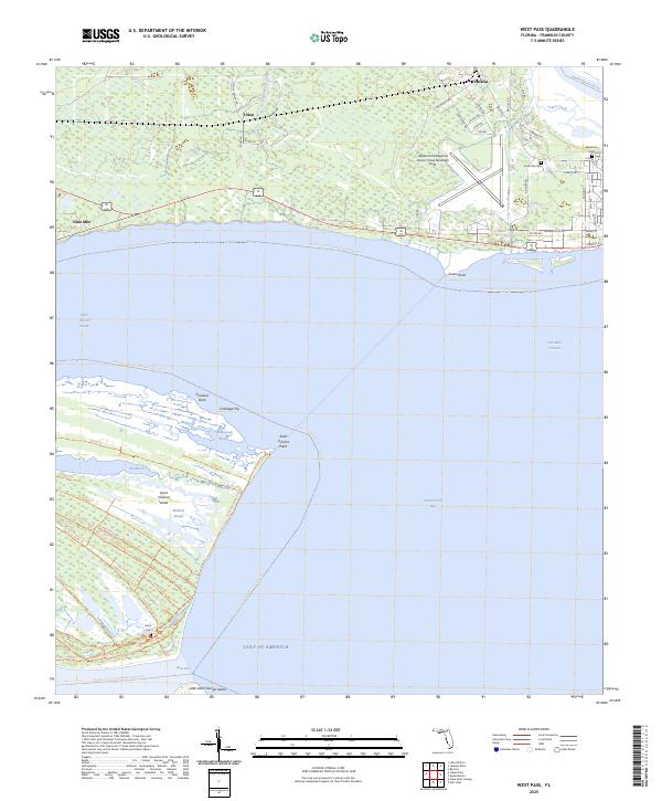
2025 Map of West Pass
USGS Topo · Published 2025About this map
Saint Vincent Island dominates this coastal survey, where a network of trails like Windmill Road Trl and G Road Trl bisect the landscape between Big Bayou and Mallard Slough. To the north, the mainland transition begins at Green Point and follows the shoreline of Saint Vincent Sound toward the settlements of Nine Mile and Tilton. The eastern portion of the map centers on the Apalachicola Regional Airport-Cleve Randolph Field, serving as a modern hub near the mouth of the Apalachicola River. Local history is anchored by sites such as Magnolia Cem and Snow Hill Cem, while the southern reaches terminate at the strategic opening of West Pass between the island and Little Saint George Island. The geography highlights a complex coastal environment where salt marshes and tidal sloughs meet established aviation and rural road infrastructure.
Find a feature on this map
64 named features on this map. Tap any name to fly to it.
Don’t see what you’re looking for? This feature index may not catch every label — zoom into the map to look around manually.
Map Details
Editions of this 2025 West Pass Map
This is the sole edition of this map. No revisions or reprints were ever made.
Other maps of this area

1943 · West Pass
USGS Topo · 1:31,680

1943 · Apalachicola
USGS Topo · 1:31,680

1943 · Indian Pass
USGS Topo · 1:24,000

1943 · Jackson River
USGS Topo · 1:24,000

1944 · Apalachicola
USGS Topo · 1:24,000

1945 · Cape St. George
USGS Topo · 1:31,680

1945 · Lake Wimico
USGS Topo · 1:31,680

1945 · Beverly
USGS Topo · 1:31,680

1945 · Jackson River
USGS Topo · 1:31,680

1945 · Indian Pass
USGS Topo · 1:31,680