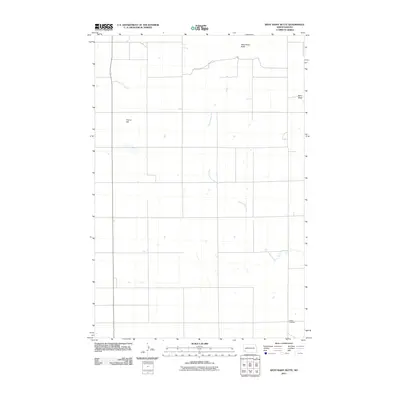
2011 Map of West Rainy Butte
USGS Topo · Published 2011About this map
West Rainy Butte and Rainy Butte rise as the defining elevations in this part of Slope County, anchoring a landscape where the high plains meet traditional ranching and farming lands. The meandering course of Chanta Peta Creek provides a natural drainage route across the prairie, drawing a sharp contrast to the rigid grid of rural section roads that crisscross the terrain. For those tracing local heritage, the DeSart Cemetery in the southeastern corner serves as a significant marker of early settlement and community identity in this open country. To the west, Prairie Hill offers another distinct landmark in an area defined by wide vistas and the isolation of North Dakota's western reaches. This 2011 survey reflects the enduring character of the high plains, showing a sparsely populated region where the environment and early burial grounds remain the most prominent features of the map.
Find a feature on this map
5 named features on this map. Tap any name to fly to it.
Don’t see what you’re looking for? This feature index may not catch every label — zoom into the map to look around manually.
Map Details
Editions of this 2011 West Rainy Butte Map
This is the sole edition of this map. No revisions or reprints were ever made.
Other maps of this area

1953 · Dickinson
USGS Topo · 1:250,000

1957 · Dickinson
USGS Topo · 1:250,000

1961 · Daglum
USGS Topo · 1:62,500

1973 · White Lake
USGS Topo · 1:24,000

1973 · Warnke Hill
USGS Topo · 1:24,000

1973 · Mineral Springs
USGS Topo · 1:24,000

1973 · Cedar Lake
USGS Topo · 1:24,000

1973 · West Rainy Butte
USGS Topo · 1:24,000

1973 · East Rainy Butte
USGS Topo · 1:24,000

1973 · New England SW
USGS Topo · 1:24,000