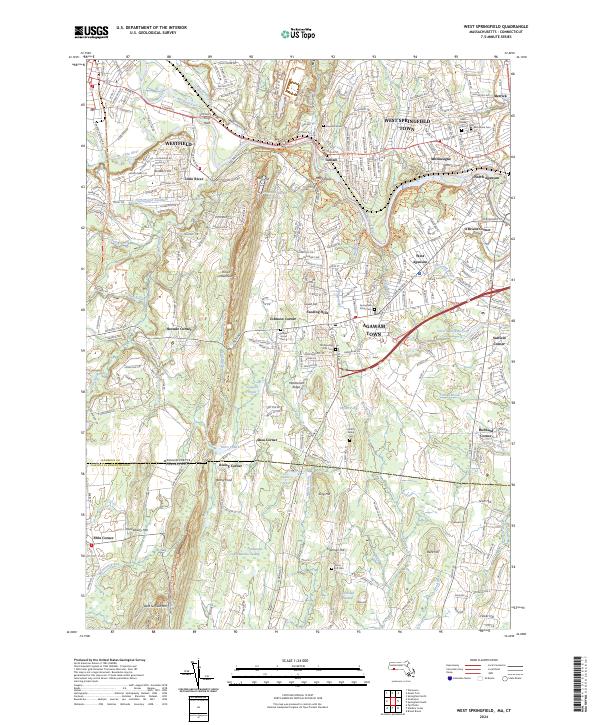
2024 Map of West Springfield
USGS Topo · Published 2024About this map
The Westfield River meanders through the heart of this region, defining the landscape between Westfield and West Springfield Town. This terrain is characterized by the prominent Metacomet Ridge and Provin Mountain, which host the New England National Scenic Trail. The map reveals a dense network of smaller residential clusters and crossroads, such as Tatham, Mittineague, and Feeding Hills, interspersed with significant municipal infrastructure like the Provin Mountain Reservoir and the Springfield Aqueduct.
Find a feature on this map
71 named features on this map. Tap any name to fly to it.
Don’t see what you’re looking for? This feature index may not catch every label — zoom into the map to look around manually.
Map Details
Editions of this 2024 West Springfield Map
This is the sole edition of this map. No revisions or reprints were ever made.
Other maps of this area

1886 · Springfield
USGS Topo · 1:62,500

1887 · Granville
USGS Topo · 1:62,500

1889 · Springfield
USGS Topo · 1:62,500

1889 · Granville
USGS Topo · 1:62,500

1892 · Hartford
USGS Topo · 1:62,500

1892 · Granby
USGS Topo · 1:62,500

1893 · Springfield
USGS Topo · 1:62,500

1893 · Granville
USGS Topo · 1:62,500

1895 · Springfield
USGS Topo · 1:62,500

1895 · Granville
USGS Topo · 1:62,500