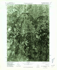
1975 Map of West Springfield
USGS Topo · Published 1981About this map
The Westfield River carves through this mid-1970s landscape, illustrating the transition between the urbanized riverbanks of West Springfield and the agricultural fringes of the Connecticut River Valley. This orthophotoquad captures a detailed overhead view of the region, showing the sprawling residential and industrial footprints in Westfield contrasted against the prominent ridge of Provin Mountain. Several smaller, distinct communities are visible, such as West Agawam, alongside named intersections like Hosmer Corner and Hubbard Corner that hint at the area's older local landmarks. The confluence where the Little River meets the larger waterway serves as a focal point for the western portion of the sheet. For local historians, this imagery provides a precise look at the development patterns and land use in Hampden County before the suburban growth of the late 20th century further altered the landscape near Rising Corner.
Find a feature on this map
9 named features on this map. Tap any name to fly to it.
Don’t see what you’re looking for? This feature index may not catch every label — zoom into the map to look around manually.
Map Details
Editions of this 1975 West Springfield Map
This is the sole edition of this map. No revisions or reprints were ever made.
Other maps of this area

1886 · Springfield
USGS Topo · 1:62,500

1887 · Granville
USGS Topo · 1:62,500

1889 · Springfield
USGS Topo · 1:62,500

1889 · Granville
USGS Topo · 1:62,500

1892 · Hartford
USGS Topo · 1:62,500

1892 · Granby
USGS Topo · 1:62,500

1893 · Springfield
USGS Topo · 1:62,500

1893 · Granville
USGS Topo · 1:62,500

1895 · Springfield
USGS Topo · 1:62,500

1895 · Granville
USGS Topo · 1:62,500