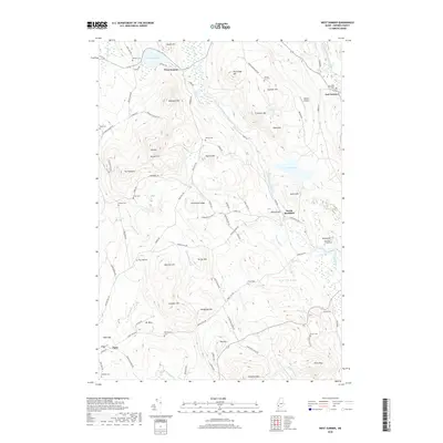
2018 Map of West Sumner
USGS Topo · Published 2018About this map
The West Branch Nezinscot River winds through this Oxford County landscape, shaping the development of West Sumner and East Sumner. This 2018 survey reveals a topography defined by significant rises such as Mt Tom and Streaked Mtn, while the valleys are dotted with ancestral sites like the Sumner Hill Cem and Buckfield Village Cem. The map illustrates the persistent rural character of the region, where the historical settlement of Paris Hill sits adjacent to more modern features like Abbots Airport.
Find a feature on this map
101 named features on this map. Tap any name to fly to it.
Don’t see what you’re looking for? This feature index may not catch every label — zoom into the map to look around manually.
Map Details
Editions of this 2018 West Sumner Map
This is the sole edition of this map. No revisions or reprints were ever made.
Other maps of this area

1896 · Norway
USGS Topo · 1:62,500

1908 · Poland
USGS Topo · 1:62,500

1911 · Bryant Pond
USGS Topo · 1:62,500

1911 · Buckfield
USGS Topo · 1:62,500

1913 · Buckfield
USGS Topo · 1:62,500

1914 · Bryant Pond
USGS Topo · 1:62,500

1940 · Poland
USGS Topo · 1:62,500

1942 · Buckfield
USGS Topo · 1:62,500

1942 · Bryant Pond
USGS Topo · 1:62,500

1942 · Poland
USGS Topo · 1:62,500