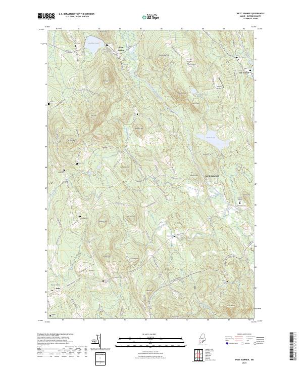
2024 Map of West Sumner
USGS Topo · Published 2024About this map
West Sumner and East Sumner anchor this pocket of Oxford County, where the topography is defined by significant elevations like Mt Tom and the distinct peaks of the Spruce Hills. The West Branch Nezinscot River snakes through the center of the sheet, fed by numerous seasonal flows including Darnit Brook and Basin Falls Brook. This landscape is heavily marked by its genealogical record, featuring over a dozen burial grounds such as Robinson Cem, Stetson Cem, and Whittemore Cem tucked away on rural roads. The concentration of family-named landmarks like Cushman Hill and Ryerson Hill suggests a long history of generational landholding. Small-scale infrastructure is visible at Abbotts Airport near the northern boundary, while the village of Paris Hill occupies the southwestern corner, overlooking Stony Brook.
Find a feature on this map
108 named features on this map. Tap any name to fly to it.
Don’t see what you’re looking for? This feature index may not catch every label — zoom into the map to look around manually.
Map Details
Editions of this 2024 West Sumner Map
This is the sole edition of this map. No revisions or reprints were ever made.
Other maps of this area

1896 · Norway
USGS Topo · 1:62,500

1908 · Poland
USGS Topo · 1:62,500

1911 · Bryant Pond
USGS Topo · 1:62,500

1911 · Buckfield
USGS Topo · 1:62,500

1913 · Buckfield
USGS Topo · 1:62,500

1914 · Bryant Pond
USGS Topo · 1:62,500

1940 · Poland
USGS Topo · 1:62,500

1942 · Buckfield
USGS Topo · 1:62,500

1942 · Bryant Pond
USGS Topo · 1:62,500

1942 · Poland
USGS Topo · 1:62,500