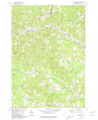
1981 Map of West Topsham
USGS Topo · Published 1981About this map
West Topsham and the surrounding rural townships of Orange and Corinth are defined by the winding course of the Waits River and its numerous tributaries. This early 1980s landscape is a complex of high ridges and narrow valley settlements, where small community centers like West Corinth and Corinth Center are linked by a network of secondary roads and trails. The presence of several family-named landmarks, such as Pierson Hill and Williams Hill, alongside the Hutchinson Cem and Fellows Cem, provides a detailed view of the regional genealogy and historical land ownership.
Find a feature on this map
41 named features on this map. Tap any name to fly to it.
Don’t see what you’re looking for? This feature index may not catch every label — zoom into the map to look around manually.
Map Details
Editions of this 1981 West Topsham Map
This is the sole edition of this map. No revisions or reprints were ever made.
Other maps of this area

1896 · Strafford
USGS Topo · 1:62,500

1931 · Mt. Cube
USGS Topo · 1:62,500

1931 · Woodsville
USGS Topo · 1:48,000

1933 · Mt. Cube
USGS Topo · 1:62,500

1935 · Woodsville
USGS Topo · 1:62,500

1941 · Woodsville
USGS Topo · 1:62,500

1944 · Strafford
USGS Topo · 1:62,500

1947 · Corinth
USGS Topo · 1:62,500

1948 · East Barre
USGS Topo · 1:62,500

1950 · Glens Falls
USGS Topo · 1:250,000