2023 Map of West Winfield
USGS Topo · Published 2023About this map
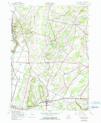
West Winfield and the surrounding dairy country of Oneida and Herkimer Counties define this corridor, where the headwaters of the Unadilla River begin their southward descent. The landscape is marked by a series of distinct upland features like Babcock Hill and Wheelock Hill, separated by the broad Bridgewater Flats. The settlement pattern reflects the area's agricultural and transit history, with small hamlets like Clayville and Unadilla Forks positioned along watercourses and historic road junctions. Genealogists will find a high density of burial sites including Jerusalem Hill Cem, Meeting House Green Cem, and Saint Joseph's Cem. The map also captures the path of the West Branch Unadilla River and the small-scale commerce centers at Hitching Corner and Birmingham Corners, illustrating the enduring rural character of these New York townships.
Find a feature on this map
112 named features on this map. Tap any name to fly to it.
Don’t see what you’re looking for? This feature index may not catch every label — zoom into the map to look around manually.
Map Details
Editions of this 2023 West Winfield Map
This is the sole edition of this map. No revisions or reprints were ever made.
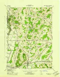
Historical Maps of Jersalem Hill Through Time
3 maps found