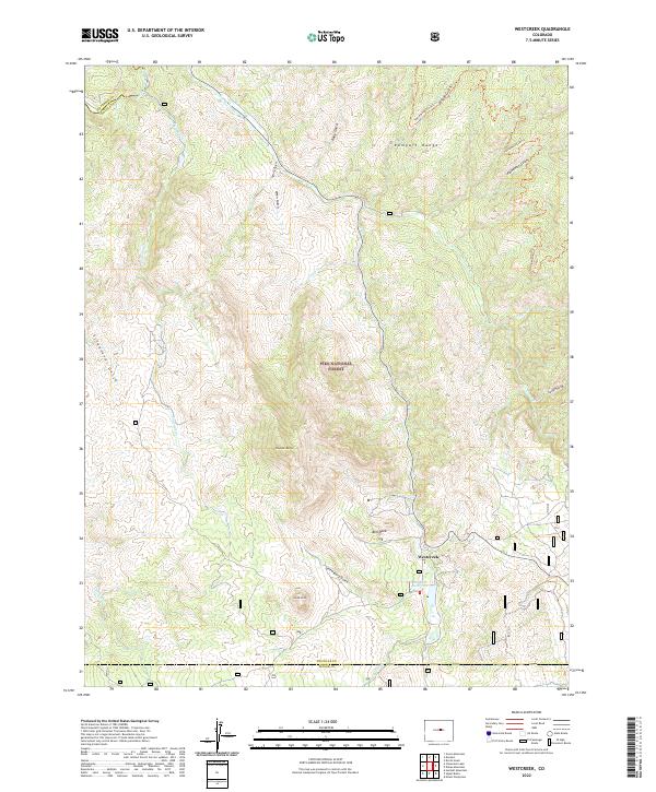
2022 Map of Westcreek
USGS Topo · Published 2022About this map
The settlement of Westcreek occupies a central position within this portion of the Pike National Forest, where the terrain transitions through the high peaks of the Rampart Range. This landscape is defined by its deep drainages and granite landmarks, including Thunder Butte, Sheep Nose, and the massive Bell Rock overlooking the valley. The waterway network is dense, with Trout Cr flowing near the townsite and the South Platte River cutting through the northwestern corner. Local engineering is evident at the J-O-Hill Reservoir, which manages water within this steep environment. Numerous gulches such as Schoonover Gulch and Shrewsbury Gulch carve the forest floor, illustrating the complex hydrology that historically shaped development in this mountain corridor between Douglas and Teller counties.
Find a feature on this map
32 named features on this map. Tap any name to fly to it.
Don’t see what you’re looking for? This feature index may not catch every label — zoom into the map to look around manually.
Map Details
Editions of this 2022 Westcreek Map
This is the sole edition of this map. No revisions or reprints were ever made.
Other maps of this area

1893 · Platte Canyon
USGS Topo · 1:125,000

1953 · Denver
USGS Topo · 1:250,000

1954 · Devils Head
USGS Topo · 1:24,000

1954 · Deckers
USGS Topo · 1:24,000

1954 · Green Mountain
USGS Topo · 1:24,000

1954 · Mount Deception
USGS Topo · 1:24,000

1954 · Signal Butte
USGS Topo · 1:24,000
1956 · Dakan Mountain
USGS Topo · 1:24,000

1956 · Hackett Mountain
USGS Topo · 1:24,000
1956 · Cheesman Lake
USGS Topo · 1:24,000