
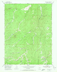
1954 Map of Signal Butte
USGS Topo · Published 1955About this map
The Pike National Forest dominates this mid-century landscape, characterized by a series of working ranch properties and early forest management sites. The presence of the Old Phantom Creek Ranger Station (Site) marks a point of historical transition in administrative land use, while established holdings like Turkey Rock Ranch, Lost Valley Ranch, and Rideout Ranch define the private enclave within the public timberlands. A dense network of waterways, including Turkey Creek, West Manchester Creek, and the North Fork, feeds numerous Beaver Ponds, suggesting a landscape shaped by active hydrology and riparian habitat.
Find a feature on this map
28 named features on this map. Tap any name to fly to it.
Don’t see what you’re looking for? This feature index may not catch every label — zoom into the map to look around manually.
Map Details
Editions of this 1954 Signal Butte Map
4 editions found
Other maps of this area

1893 · Platte Canyon
USGS Topo · 1:125,000

1894 · Pikes Peak
USGS Topo · 1:125,000

1901 · Pikes Peak
USGS Topo · 1:125,000

1901 · Pikes Peak
USGS Topo · 1:62,500

1953 · Denver
USGS Topo · 1:250,000

1954 · Mount Deception
USGS Topo · 1:24,000

1954 · Woodland Park
USGS Topo · 1:24,000

1954 · Divide
USGS Topo · 1:24,000

1954 · Pueblo
USGS Topo · 1:250,000
1956 · Dakan Mountain
USGS Topo · 1:24,000