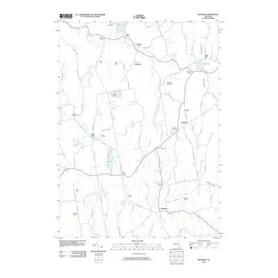
2010 Map of Westerlo
USGS Topo · Published 2010About this map
Westerlo serves as the primary hub in this Albany County landscape, situated amidst a terrain defined by significant peaks and small rural hamlets. The geography is shaped by the Helderberg mountains and prominent elevations like Wolf Hill and Irish Hill, which dictate the drainage patterns of waterways such as Basic Creek and the Switz Kill. This 2010 survey illustrates a region where traditional agricultural land, evidenced by Morning Fog Farm and Mountain View Farm, exists alongside recreational sites like Camp Orinsekwa and Camp Woodstock. Numerous crossroads settlements, including Bramans Corners, Ford Corners, and Snyders Corners, reflect a long-standing pattern of dispersed local commerce. For genealogists, the map provides precise locations for several burial grounds, including the Westerlo Cemetery, Reidsville Cemetery, and Snyder Cemetery, which remain key landmarks for tracing family history in the area.
Find a feature on this map
84 named features on this map. Tap any name to fly to it.
Don’t see what you’re looking for? This feature index may not catch every label — zoom into the map to look around manually.
Map Details
Editions of this 2010 Westerlo Map
This is the sole edition of this map. No revisions or reprints were ever made.
Other maps of this area

1893 · Coxsackie
USGS Topo · 1:62,500

1893 · Durham
USGS Topo · 1:62,500

1893 · Albany
USGS Topo · 1:62,500

1894 · Coxsackie
USGS Topo · 1:62,500

1894 · Durham
USGS Topo · 1:62,500

1895 · Albany
USGS Topo · 1:62,500

1898 · Albany
USGS Topo · 1:62,500

1900 · Berne
USGS Topo · 1:62,500

1903 · Berne
USGS Topo · 1:62,500

1927 · Albany
USGS Topo · 1:62,500