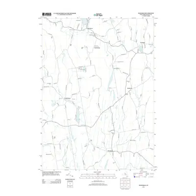
2013 Map of Westerlo
USGS Topo · Published 2013About this map
The agrarian and residential hills of Albany County come into focus through the hamlet of Westerlo and several outlying rural settlements. The landscape is defined by its water and high ground, featuring Warner Lake and Onderdonk Lake alongside significant peaks such as Irish Hill, Cole Hill, and Filkin Hill. The map reveals a cluster of 21st-century aviation and recreation sites, including the Westerlo Airport, Heldeberg Airstrip, and Waxwing Airport, which sit alongside historic community markers like the Rural Cem and Reidsville Cem. The winding path of Fox Cr and Basic Cr underscores the area's drainage patterns, while small farming operations like Mountain View Farm and Morning Fog Farm show the continued agricultural character of the region near Bensons Corners and Reidsville.
Find a feature on this map
121 named features on this map. Tap any name to fly to it.
Don’t see what you’re looking for? This feature index may not catch every label — zoom into the map to look around manually.
Map Details
Editions of this 2013 Westerlo Map
This is the sole edition of this map. No revisions or reprints were ever made.
Other maps of this area

1893 · Coxsackie
USGS Topo · 1:62,500

1893 · Durham
USGS Topo · 1:62,500

1893 · Albany
USGS Topo · 1:62,500

1894 · Coxsackie
USGS Topo · 1:62,500

1894 · Durham
USGS Topo · 1:62,500

1895 · Albany
USGS Topo · 1:62,500

1898 · Albany
USGS Topo · 1:62,500

1900 · Berne
USGS Topo · 1:62,500

1903 · Berne
USGS Topo · 1:62,500

1927 · Albany
USGS Topo · 1:62,500