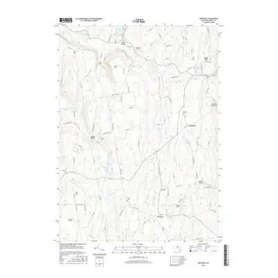
2016 Map of Westerlo
USGS Topo · Published 2016About this map
Westerlo and East Berne serve as the primary hubs in this part of the Helderberg Mountains, where the landscape is defined by a series of prominent elevations like Irish Hill, Cole Hill, and Wolf Hill. The region's drainage pattern is dominated by the Switz Kill, Fox Cr, and Basic Cr, which cut through the uplands to feed several notable bodies of water, including Warner Lake and Onderdonk Lake. The settlement pattern follows these watercourses and ridgelines, with small communities like Reidsville and Dunbar Hollow connected by a network of rural roads such as Switzkill Rd and Albany Hill Rd. Local history is preserved in several small burying grounds, including Snyder Cem and Reidsville Cem, while the area's modern connectivity is illustrated by the presence of small private flight strips like the Westerlo Airport and Heldeberg Airstrip.
Find a feature on this map
104 named features on this map. Tap any name to fly to it.
Don’t see what you’re looking for? This feature index may not catch every label — zoom into the map to look around manually.
Map Details
Editions of this 2016 Westerlo Map
This is the sole edition of this map. No revisions or reprints were ever made.
Other maps of this area

1893 · Coxsackie
USGS Topo · 1:62,500

1893 · Durham
USGS Topo · 1:62,500

1893 · Albany
USGS Topo · 1:62,500

1894 · Coxsackie
USGS Topo · 1:62,500

1894 · Durham
USGS Topo · 1:62,500

1895 · Albany
USGS Topo · 1:62,500

1898 · Albany
USGS Topo · 1:62,500

1900 · Berne
USGS Topo · 1:62,500

1903 · Berne
USGS Topo · 1:62,500

1927 · Albany
USGS Topo · 1:62,500