
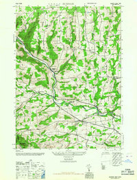
2023 Map of Westerlo
USGS Topo · Published 2023About this map
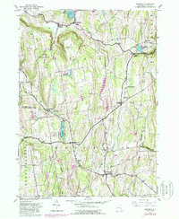
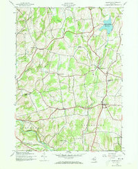
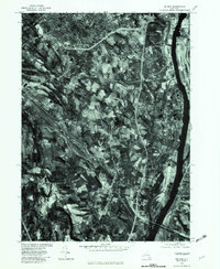
Westerlo and the surrounding Albany County uplands are defined by the prominent Helderberg Mountains and a series of high ridges including Cole Hill and Wolf Hill. This landscape is deeply etched by watercourses such as Fox Creek and Basic Creek, which flow through valleys that have long dictated the placement of local settlements and roads. The area's agrarian and small-town character is preserved in the spacing of communities like South Berne and East Berne, where the road network follows the contours of the hills. For local historians and genealogists, the map provides precise locations for several burying grounds, including the South Berne Rural Cem and Snyder Cem. Recreational and residential pockets are clustered around Warners Lake and Onderdonk Lake, while the Long Path Trail traverses the western hills, tracing the high ground of the Switz Kill valley.
Find a feature on this map
99 named features on this map. Tap any name to fly to it.
Don’t see what you’re looking for? This feature index may not catch every label — zoom into the map to look around manually.
Map Details
Editions of this 2023 Westerlo Map
This is the sole edition of this map. No revisions or reprints were ever made.
Historical Maps of East Berne Through Time
20 maps found
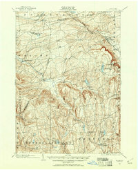
1900 Berne
Albany County, NY
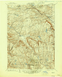
1903 Berne
Albany County, NY
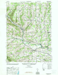
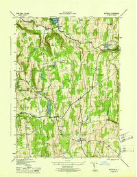
1943 Westerlo
Albany County, NY
1945 Durham
Albany County, NY
1945 Greenville
Albany County, NY
1946 Durham
Albany County, NY
1946 Greenville
Albany County, NY
1946 Rensselaerville
Albany County, NY
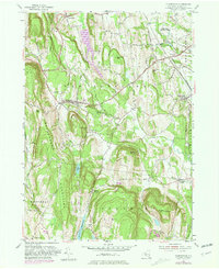
1946 Westerlo
Albany County, NY
1953 Clarksville
Albany County, NY
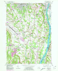
1953 Delmar
Albany County, NY
1967 Durham
Albany County, NY
1978 Delmar
Albany County, NY
1980 Greenville
Albany County, NY

2023 Clarksville
Albany County, NY

2023 Delmar
Albany County, NY

2023 Durham
Albany County, NY

2023 Greenville
Albany County, NY

2023 Rensselaerville
Albany County, NY
2023 Westerlo
Albany County, NY