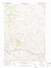
1966 Map of Westfall Butte
USGS Topo · Published 1980About this map
Jonesboro and the Union Pacific railroad line define the southern corridor of this high desert landscape during the mid-1960s. The railroad follows the winding course of the Malheur River, marked by technical features like the Tunnel Spur and various mile markers. Above the river valley, the terrain is a complex network of volcanic landforms and water management, including Westfall Butte, Kelsey Butte, and South Mountain.
Find a feature on this map
81 named features on this map. Tap any name to fly to it.
Don’t see what you’re looking for? This feature index may not catch every label — zoom into the map to look around manually.
Map Details
Editions of this 1966 Westfall Butte Map
2 editions found

Other maps of this area

1908 · Ironside Mountain
USGS Topo · 1:125,000

1955 · Baker
USGS Topo · 1:250,000

1955 · Burns
USGS Topo · 1:250,000

1955 · Canyon City
USGS Topo · 1:250,000

1955 · Boise
USGS Topo · 1:250,000

1958 · Burns
USGS Topo · 1:250,000

1958 · Boise
USGS Topo · 1:250,000

1959 · Baker
USGS Topo · 1:250,000

1959 · Burns
USGS Topo · 1:250,000

1959 · Canyon City
USGS Topo · 1:250,000