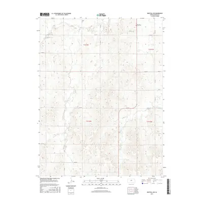
2015 Map of Westfall NW
USGS Topo · Published 2015About this map
Saint John Lutheran Cem and Heiser Cem stand as quiet markers of the early settlement patterns in this rural section of Lincoln County. The landscape is defined by the winding paths of Bullfoot Cr, Spring Cr, and W Elkhorn Cr, which carve through the terrain and dictate the placement of local homesteads and roads. The section lines of the Public Land Survey System remain the primary organizing force for the local infrastructure, with roads like E Iron Dr and E Elk Dr following the rigid grid established by the T12S and T13S townships. This map captures a modern view of a traditional Kansas agricultural landscape, where the naming of local thoroughfares such as E Bison Dr and E Colt Dr reflects the region's enduring connection to its prairie heritage.
Find a feature on this map
22 named features on this map. Tap any name to fly to it.
Don’t see what you’re looking for? This feature index may not catch every label — zoom into the map to look around manually.
Map Details
Editions of this 2015 Westfall NW Map
This is the sole edition of this map. No revisions or reprints were ever made.
Other maps of this area

1894 · Ellsworth
USGS Topo · 1:125,000

1894 · Beloit
USGS Topo · 1:125,000

1955 · Great Bend
USGS Topo · 1:250,000

1955 · Beloit
USGS Topo · 1:250,000

1957 · Great Bend
USGS Topo · 1:250,000

1957 · Westfall SW
USGS Topo · 1:24,000

1957 · Westfall SE
USGS Topo · 1:24,000

1957 · Black Wolf
USGS Topo · 1:24,000

1958 · Great Bend
USGS Topo · 1:250,000

1959 · Beloit
USGS Topo · 1:250,000