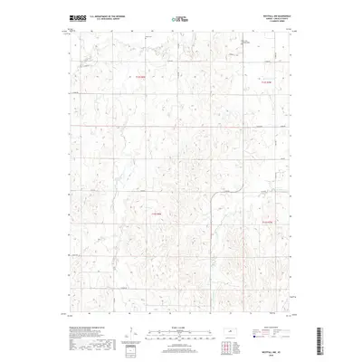
2018 Map of Westfall NW
USGS Topo · Published 2018About this map
Saint John Lutheran Cem and Heiser Cem stand as quiet markers of the early settlement patterns in this rural portion of Lincoln County. The landscape is deeply carved by a network of drainage systems, including the branching reaches of Bullfoot Cr in the north and the winding paths of Spring Cr and West Elkhorn Creek further south. These waterways dictate the local topography, with high ridges separated by narrow valleys where the county's section-line roads must often bend to accommodate the terrain. The map detail reflects a strictly agrarian structure, organized by the township and range lines of t12s r8w, t12s r7w, t13s r8w, and t13s r7w. Apart from these historic burial grounds and the persistent creek beds, the map shows a modern rural infrastructure defined by a grid of named routes like E Elk Dr and N 170th Rd.
Find a feature on this map
20 named features on this map. Tap any name to fly to it.
Don’t see what you’re looking for? This feature index may not catch every label — zoom into the map to look around manually.
Map Details
Editions of this 2018 Westfall NW Map
This is the sole edition of this map. No revisions or reprints were ever made.
Other maps of this area

1894 · Ellsworth
USGS Topo · 1:125,000

1894 · Beloit
USGS Topo · 1:125,000

1955 · Great Bend
USGS Topo · 1:250,000

1955 · Beloit
USGS Topo · 1:250,000

1957 · Great Bend
USGS Topo · 1:250,000

1957 · Westfall SW
USGS Topo · 1:24,000

1957 · Westfall SE
USGS Topo · 1:24,000

1957 · Black Wolf
USGS Topo · 1:24,000

1958 · Great Bend
USGS Topo · 1:250,000

1959 · Beloit
USGS Topo · 1:250,000